Salience has a track record of innovation in Science, Technology, CONOPS, information from data, automated self-cueing, etc. For example:
Examples 1-3 were done under contract to DND
- Using ontologies and automated reasoning to achieve or enhance a structured Situational Awareness (i.e. a set of situational facts) for an operationally relevant domain. See Example 1
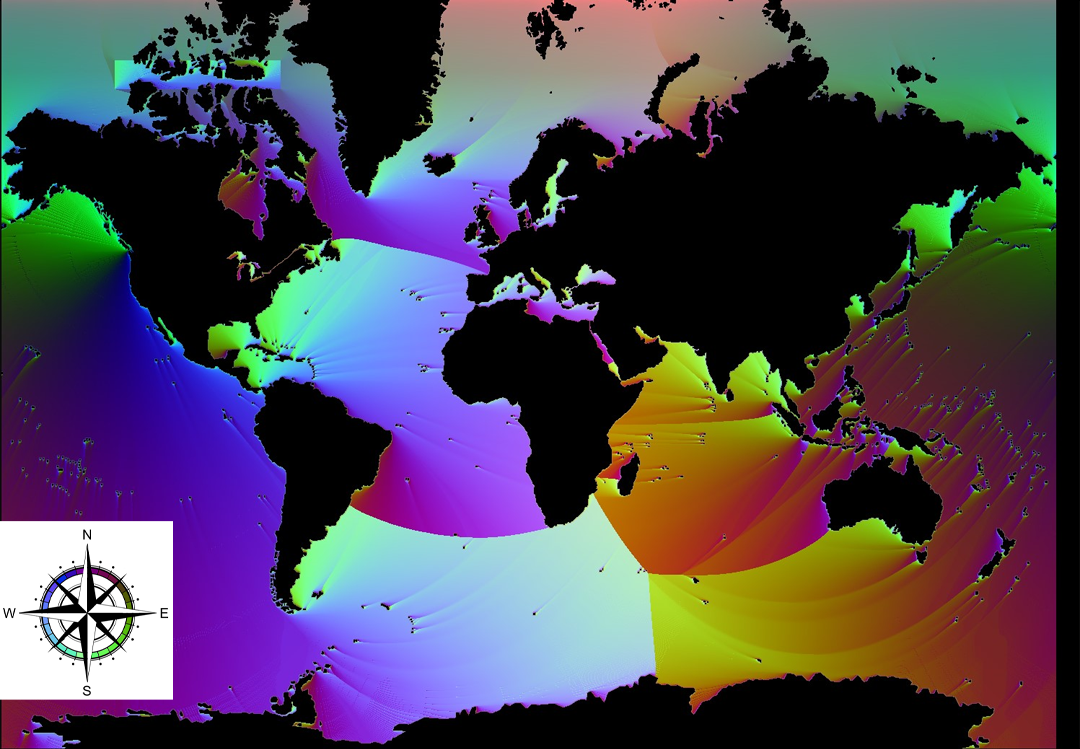
- Automated planning. See Example 2 for one example of automated route planning, in this case using Value Iteration (ref: Dijkstra)
- Analysis of how automated situation analysis can support applications such as:
- Situational Awareness
- National Security
- Sovereignty
- Illegal Fishing
- Illegal Migration
- Safety of Life at Sea
- Remote Sensing Missions: Polar Epsilon SAR, optical, hyperspectral, on-board processing with advanced algorithms
Examples 1-3 were done under contract to DND
Example 1: Ontology Reasoning for Situational Awareness

Work done by Salience (Mike Davenport and Jean Roy) under contract to Defence E&D Canada
Salience built a Maritime Domain Ontology proof-of-concept prototype of an automated reasoner for situational awareness. The automated reasoner exploits ontologies expressed in description logic to support the maritime staff in:
Salience built a Maritime Domain Ontology proof-of-concept prototype of an automated reasoner for situational awareness. The automated reasoner exploits ontologies expressed in description logic to support the maritime staff in:
- detecting anomalies
- classifying vessels of interest
- identifying and categorizing Maritime threats
Example 2: Dijkstra's Automated Planning for Ship Routing
1) Start at any ocean pixel
2) Refer the pixel colour at your current location to the matching heading on the compass rose
3) steer that compass heading, changing the heading as the map colour changes
4) repeat until you arrive at Vancouver (Dijkstra's algorithm, implemented and plotted by Salience)
2) Refer the pixel colour at your current location to the matching heading on the compass rose
3) steer that compass heading, changing the heading as the map colour changes
4) repeat until you arrive at Vancouver (Dijkstra's algorithm, implemented and plotted by Salience)
Example 3: Deep Pan Sharpening
a) Start with a high spatial-resolution Panchromatic image (SAR or Optical) plus a low spatial-resolution colour image (e.g. RGB or multi-band)
b) images may have been taken at different times
c) fuse them together for high spatial resolution and spectral fidelity
b) images may have been taken at different times
c) fuse them together for high spatial resolution and spectral fidelity

